
Limerick Township Street Directory Route
For a known Limerick Township address, use an address-to-record route. Montgomery County Property Records is the starting point because it is built for a street address or parcel ID. Save the parcel ID, then use the map and the recorded-document trail. The result may establish the assessed parcel, a mailing field where the card displays one, and a recorded ownership history. It does not identify every person living at that address.
The order matters. The County discontinued owner-name searching on June 17, 2022, so a person-name search cannot be forced through the property portal. Start with the street number and road, not a guessed owner. A parcel ID is the durable bridge when a road name has a variation or when an old document describes a lot rather than a modern house number.
- Enter the known address in County Property Records and preserve the situs address and parcel ID exactly as returned.
- Open the parcel in the County map to see its relationship to the road and nearby parcels. Treat the display as visual context, not a surveyed boundary.
- Use the parcel, legal description, sale lead, and recorded parties to search the Recorder’s document index for the relevant transaction.
- For a dated project or address file, ask Township Planning and Zoning for the specific permit, plan, or hearing record and give a time range.
- For a historic household question, change sources to the Historical Society rather than treating a current tax card as a historical resident list.
That walk is the useful core of a Limerick Township street directory: address, parcel, spatial context, document, then the right local file. It leaves room for a no-result, which is better than turning a tax record into an unsupported statement about an occupant.
Limerick Township Address First
Address-first research is not a shortcut around the County’s privacy choice. The County’s Board of Assessment Appeals guidance says the property system offers address and parcel searches but no longer offers owner-name search. A property card can show assessment and building information, a sales-history lead, map context, and sometimes mailing-owner information. Each item is tied to the parcel and its record date.
A mailing address is especially easy to misread. It is the place where assessment correspondence is sent. It may be a post-office box, a trustee, a business, a manager, or another home. The situs address is the physical location of the parcel. Neither field proves that the tax owner lives there, and neither names renters or other household members. That distinction keeps a by-address search specific and fair.
Limerick Township Street Search Fields
The County portal’s public navigation makes the available routes clear. Search by Address and Search by Parcel are the dependable choices for a specific Limerick Township property. The terms screen comes first. Exact subfields in the live address form should be checked at the time of a search, but the County’s documented modes and limits are stable enough to choose the correct path without inventing an owner search.
| County property control | Input type | When it is required | Useful Limerick Township use |
|---|---|---|---|
| Search by Address | Address text | Required for that mode | Begin with the situs street information for a known property. |
| Search by Parcel | Parcel-ID text | Required for that mode | Use when road wording varies or a numbered street address is not useful. |
| Advanced Search | Multiple criteria | Depends on live selections | Check the current interface before relying on a field or dropdown. |
| Map Search | Map selection | No text query | Select a subject parcel, then open its property or map modules. |
| Sales Search | Sale and property criteria | Depends on live selections | Use as a transfer lead, then verify against Recorder records. |
| Search by Owner | Former mode | Not available | Removed by the County for privacy reasons. |
The property profile itself can return a parcel ID, owner name, property address, sales date and amount, land-use code, alternate ID, assessment history, map, photos, sales, sketch, splits or combinations, and assessment-system permit tabs. These are portal fields, not a title guarantee. Preserve the source and date before comparing a result with a deed or plan.
Limerick Township Street Map Context
Montgomery County’s Interactive Tax Map supplies the spatial step in a street directory search. Use it to locate a road segment, select the subject parcel, see adjoining parcels, and return to the individual property profile when available. The County provides this map to understand parcel relationships. It does not establish a boundary line, title, survey result, zoning certification, or permit history.
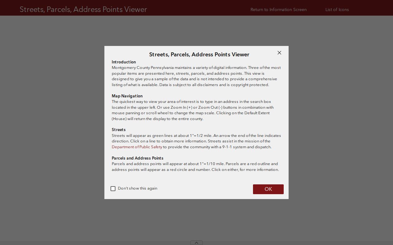
The map is most useful after an address has already produced a parcel. County property records update weekly while map data update daily, so the two displays can be useful together but are not interchangeable. A licensed surveyor, not a mapline, decides the location of a boundary on the ground.
For a full named-street chain, inspect one parcel at a time and keep the viewer extent with the query date. This prevents a visually nearby lot from being mistaken for a lot that legally touches the subject parcel.
Limerick Township ZoningHub Search
Limerick Township ZoningHub provides a second local map view. Its public controls offer Address, Parcel Number, and Owner Name modes, along with district and land-use filters, location and map-setting controls. The map’s parcel and ownership display is useful for navigation and zoning context. Confirm an ownership statement against the County assessment record or Recorder, which are the relevant custodians.
| Field or control | Type | Required | Documented use |
|---|---|---|---|
| What? | Search-type buttons | Yes for a text search | Choose Address, Parcel Number, or Owner Name. |
| Search text | Text field | Yes for a text search | Enter an address, Tax Key or parcel, or name for the selected mode. |
| Parcel number | Formatted text | When parcel mode is used | Limerick parcel IDs begin with 3700 plus eight digits and match the Tax PIN. |
| Filter by District | Map filter | Optional | Shows zoning-district context and related standards. |
| Filter by Land Use | Map filter | Optional | Adds land-use geographic context. |
| Map Settings or layers | Map controls | Optional | Parcel and district layers can depend on zoom level. |
The search tips use single-letter directions and abbreviated street types. Starting with the smallest reliable amount of address information helps when the live map offers suggestions. A zoning overlay explains land-use context, not who lives at a Limerick Township address.
The Township’s ZoningHub map is the source for this view of its address and parcel search.
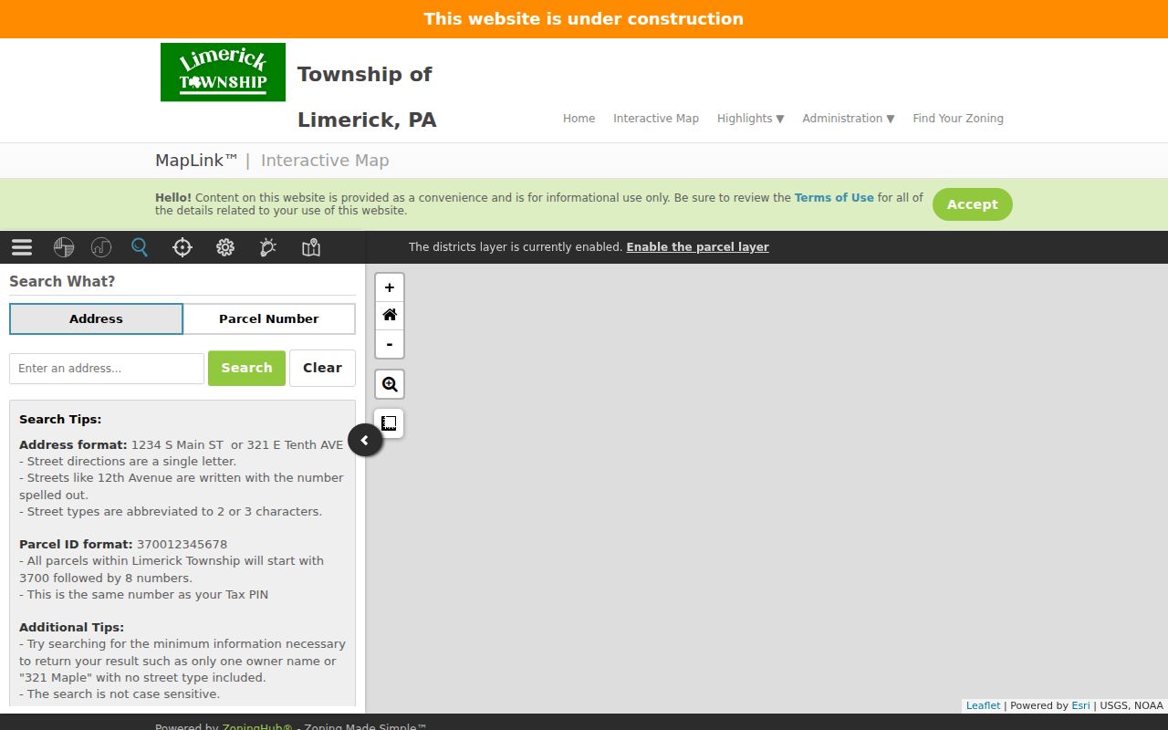
The screenshot shows why a map supports the address workflow, while the County property card and recorded documents remain the evidence to preserve for parcel and ownership facts.
Limerick Township Street Records
Different records answer different address questions. A County parcel card describes an assessed property. A map describes spatial context. A deed documents a recorded transaction. A Township plan or permit file can date a project. The following local coverage table keeps those roles apart and shows the non-portal channels when a screen result is not enough.
| Address-keyed record | Local keeper | What it can show | Access path and limit |
|---|---|---|---|
| Property record and parcel card | Board of Assessment Appeals | Situs, parcel ID, assessment and building fields, sales lead | County address or parcel portal; owner-name search is unavailable. |
| Interactive tax map | County BOA map service | Parcels and spatial relationships | Free viewer; visualization only, not a survey. |
| Zoning map | Township Planning and Zoning | Zoning context, district, land use, parcel navigation | Free ZoningHub view; verify property facts with the custodian. |
| Deeds, mortgages, and plans | Montgomery County Recorder of Deeds | Recorded parties, date, legal description, plan links | Account for index access; remote ordinary images have subscription rules. |
| Permit and land-development files | Township Planning and Zoning | Applications, plans, permits, conditions, and project chronology | Specific inquiry, counter, or RTKL request; no verified online address-history database. |
Each access path has a different purpose. County Open Data supplies free parcel datasets, and a custom County report or map can be requested through the Board of Assessment Appeals data route. A specific Township file needs an address, record class, and time period. A Recorder document may need a counter visit when a historical book or plan must be interpreted.
Note: Keep the parcel ID, source URL, and query date together so an address result can be checked later without reconstructing the search.
Limerick Township Deed Trail
A deed trail moves by parcel and legal description, not by a loose street-name match. The Recorder Public Access System dates office records to 1784. After a free account, its public search can use a real-property department, a search term, recorded-date range, and document-oriented terms. The County identifies grantor, grantee, subdivision, document type, and document number as quick-search possibilities. Check the live account flow before assuming more advanced fields.
Start with the current parcel’s recorded sale or deed lead. The grantor is the person transferring property, and the grantee is the person receiving it. Compare the legal description and plan or book reference as you move to the earlier acquisition. Older instruments may use a lot, subdivision, or plan rather than the current street number. The chain documents recorded ownership and related filings, not every occupant of a property.
Ordinary document images from home require the Recorder’s subscription, currently described as $25 for a calendar day or $300 monthly. Plain copies under subscription are 50 cents per page. A certified electronic copy is $10.50, and the Recorder says only ten documents stay in the e-certified queue. The counter at 425 Swede Street in Norristown can help with historical books, plans, and copies when the index alone is not enough.
Limerick Township Permit Files
Planning records create a dated address trail without becoming a resident list. Township code requires public records for applications, submitted plans and information, permits, special conditions, and nonconforming-use identity, location, and type. The Township permits and forms inventory includes construction, drainage, sewer, road-occupancy, zoning-use, subdivision, land-development, conditional-use, hearing, and zoning-verification material.
Ask for an existing record, not a narrative answer. Include the Limerick Township street address, parcel ID if known, file type, and date range. For records that are not available through a routine contact, use the Township’s Right-to-Know channel or its standard form. The RTKL allows a custodian to review exemptions and redactions. An application, an issued permit, and a completed project are separate facts.
Current land-use files can be particularly useful for dates. Township Planning and Zoning lists 2024 Ordinances 428 and 431 concerning data centers, and a 2026 notice reported related conditional-use applications as accepted complete with hearings not yet scheduled. Those documents describe a land-use process at an address, not personal information about people nearby.
Limerick Township Historic Addresses
Older street evidence takes a different route. No authoritative Limerick-specific reverse or criss-cross directory run was found, so it would be wrong to promise one. The Limerick Township Historical Society is the useful local fallback. Its on-site material includes a small deed collection, family files, church and cemetery transcriptions, obituaries from 1938 to 2012, memorial cards from 1944 to 2007, and funeral information for burials around 1900 to 1950.
For a historic address, first identify the property and recorded chain, then ask the Historical Society about a person, family, deed, obituary, cemetery, or funeral lead. The County’s historical property research resources point to County Archives, historical repositories, atlases, State Archives material, National Archives material, and federal land patents. Catalog-check any regional directory or telephone-book edition before treating it as Limerick evidence.
Royersford’s separate municipal history also matters. It became a separate borough in 1879 and later annexed Limerick territory, so an older record can use a different locality label. Search the deed, plan, and date rather than assuming a postal or municipal label stayed the same.
Limerick Township Street Terms
Address records use a few terms in narrow ways. Reading them correctly avoids jumping from a useful property clue to a claim about people living on a Limerick Township street.
- Parcel
- A tax-map unit with an identifier used to connect the property card, map, deed lead, and local request.
- Situs address
- The physical property location used to place a parcel on a street and map.
- Mailing address
- The assessment correspondence address, which can differ from the situs and does not prove occupancy.
- Legal description
- The lot, plan, block, or metes-and-bounds language that links a parcel to a recorded document.
- Criss-cross directory
- A historical address-to-name directory. No verified Limerick-specific run was located, so use only a catalog-confirmed edition.
These definitions also explain why the County’s address and parcel controls are more reliable starting points than a casual name search. A word that looks familiar can have a very different evidentiary role in assessment, mapping, and Recorder systems.
Limerick Township Street Directory Limits
A Limerick Township street directory can show a documented property trail, not a complete household list. Renters, adult children, guests, utility customers, delivery recipients, and many other residents are not indexed in a County property record. Motor-vehicle personal information is protected by the federal Driver’s Privacy Protection Act. A property owner, a tax mailing address, and a person physically living at an address are separate claims.
Pennsylvania’s Safe at Home Address Confidentiality Program also protects eligible survivors through a substitute-address system. The Pennsylvania Right-to-Know Law does not override confidentiality statutes or require release of protected details. Use a precise request, accept a lawful redaction or no-result, and ask the custodian how to correct an inaccurate property record.