
Limerick ZIP Code Coverage
Limerick Township is a geographic municipality in Montgomery County. Postal codes are delivery geography and postal-place labels, so their outlines do not follow Township lines. Research confirms three codes in the local record trail: 19468 is the principal postal area, while individual Township addresses also appear with 19473 and 19464. The table records what the evidence supports, not a precise neighborhood map. A complete deliverable address must still be checked individually before a code or postal city is relied on.
| Postal code | Supported local context | Post-office or postal label | Record caution |
|---|---|---|---|
| 19468 | Principal Limerick Township postal area; used by the Township municipal address | Limerick Post Office location, postal city Royersford | Royersford postal text does not replace Township verification |
| 19473 | Individual County records identify Limerick Township addresses with this code | Schwenksville postal area | Do not equate every 19473 address with Schwenksville Borough |
| 19464 | County and Township sources associate Limerick-area service or context with this code | Pottstown postal area | A Pottstown label is not necessarily Pottstown Borough |
The available sources do not publish a browsable township-by-code boundary table, and no official source maps exact Limerick subareas to all three polygons. The 19468 postal center is a practical starting point, not a municipal boundary. Note: Record the complete address and returned ZIP+4 before using a postal label in a property search.
19468 and Limerick Postal Names
The Township’s mailing address uses 19468, while the official Limerick Post Office location is listed on West Ridge Pike in Royersford with a 19468 postal city. USPS also lists a Royersford Post Office with the same code. This is a useful local lesson: an address can sit within Limerick Township yet carry Royersford as its postal city. Postal text helps route mail. It does not establish the governing municipality, parcel boundary, or historical jurisdiction.
A ZIP code is most reliable as an address-check result. Keep the street address, unit when applicable, postal city, five-digit code, and ZIP+4 together. If an older tax, deed, or family item prints a different community name, do not overwrite it with a present label. Preserve both the source wording and the later check, then use the parcel and legal description to determine where the property lies.
USPS Checks for Limerick ZIPs
The USPS ZIP Code Lookup is the final authority for the postal result of a particular deliverable address. Enter the complete street address and retain the returned postal city and ZIP+4. This is an address-level check, not a tool for browsing all Limerick residents or assembling a code-wide resident list. It should come before an assessor or map search whenever the postal label is uncertain.
| Complete street address | Enter the address as written, including the unit where relevant, to obtain a delivery result. |
|---|---|
| Postal city | Retain the returned city name as a delivery label, not as proof of Township membership. |
| Five-digit code | Use it as the starting postal reference for the record trail. |
| ZIP+4 | Keep the added delivery detail when returned because it can distinguish an address more precisely. |
After the postal result, confirm the municipality in the Montgomery County Property Records system by street address or parcel identifier. The County landing page documents address, parcel, advanced, map, and sales paths. It does not document a code-based property filter.
Limerick ZIP Code Search Limits
No official local assessment, voter, or GIS portal was documented with a ZIP-wide people or property filter. Montgomery County’s property portal provides street address, parcel ID, advanced, map, and sales access. The Limerick ZoningHub map provides Address, Parcel Number, and Owner Name modes. A searcher cannot honestly turn either portal into a ZIP-wide directory when that filter is not published.
The sound workflow is narrower: verify one address with USPS, locate the property by the confirmed street address or parcel identifier, then compare the Township and County map context. This establishes an address and parcel trail, not every person associated with a postal area. The Pennsylvania voter-status service is similarly an individual confirmation tool, not a public postal-area browser.
Boundary limit. A postal code can guide address verification, but only the parcel and Township or County records establish whether a property is in Limerick Township.
Tracing a Limerick ZIP Address
When a Limerick Township ZIP code is known, move from delivery information to property information in a fixed order. Start with the full address in USPS, then use the confirmed street address in the County property portal. Save the situs address, parcel identifier, and any sales or property-card lead. Open the map only for visual context. The County explains that parcel and map data are informational and not a substitute for a survey, title search, zoning certification, or permit review.
- Enter the complete street address in the USPS lookup and preserve the postal city, code, and ZIP+4 returned.
- Use the confirmed street address or parcel identifier in Montgomery County Property Records.
- Compare the situs address and parcel municipality with the postal result, noting rather than erasing any difference.
- Open the County map or Limerick ZoningHub for visual orientation, then return to the property record for the documented parcel facts.
- For a recorded document trail, carry the parcel identifier and legal description to the Recorder’s custodian rather than assuming a postal label is a deed description.
Once a postal area is narrowed to a particular street, the Limerick Township street address directory explains the address-led property and record sequence in more detail. The sequence starts from a property, not from a claim about who currently lives there.
Parcel IDs Behind Limerick ZIPs
The durable bridge between a postal result and land records is the parcel identifier. Limerick ZoningHub states that a Township parcel ID begins with 3700 followed by eight digits, and that this is the same as the Tax PIN. Its address guidance uses a single-letter direction and abbreviated street type. These are search conventions for map navigation, not proof of title or municipal boundaries.
- ZIP+4
- An added delivery segment returned for a specific address. It refines mail routing, not the Township line.
- PO-box ZIP
- A code used for post-office boxes rather than a map of physical addresses. None is asserted here for Limerick Township.
- Unique ZIP
- A code serving one organization or use. No such local code is claimed in the available research.
- Carrier route
- A mail-delivery grouping. It is not a property boundary or a public resident roster.
- Situs address
- The physical property address used to locate a parcel on the street and map.
A tax mailing address can have a different postal code from the situs address. A legal description or parcel ID is the more durable land-record reference and may not have a mailing code at all. Keep all three values distinct when they appear in records.
Royersford History and Limerick ZIPs
Historic postal logic is especially risky near Royersford. Limerick became part of Montgomery County in 1784, Royersford became a separate borough in 1879, and the Limerick Township Historical Society notes later annexations affecting former Limerick territory. The local historical material identifies 1924 as a third annexation, while a 1930 census source refers to an annexation in 1926. These records should not be flattened into one rule for every parcel.
For older research, search the street and legal description in both Limerick and adjacent Royersford contexts. Then ask the Recorder, County Archives, or Historical Society for a dated map, plan, tax record, or directory. A 19468 label beside Royersford can be a postal identity mismatch rather than evidence of a move. Note: Use the date printed on the source when comparing a postal label with Township history.
Limerick ZIP Maps Need Caution
The Township’s official map supplies a long road index and grid references. It was adopted in 2011 and last revised January 31, 2023. The map helps orient a modern street but expressly is not for engineering use, and its historic aerial, tax-map, and field-survey layers do not create a legal boundary by themselves. Treat it as an orientation tool after an address-level USPS check and before a custodian confirms the parcel record.
Limerick ZoningHub adds Township zoning and parcel context with configurable parcel and district layers. Its instructions warn that not all parcels display until the map is zoomed in. The map is useful for moving from a confirmed address to a visible parcel, but County assessment and Recorder records remain the authority for any ownership statement.
The Township’s ZoningHub map is the documented source for the parcel-viewer interface.
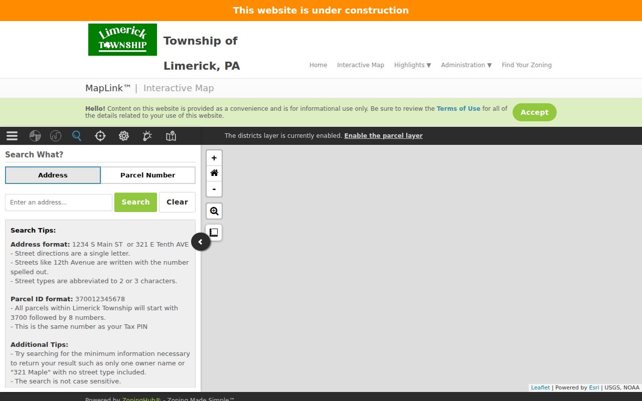
Use the display to orient the confirmed property, then preserve the underlying address, parcel ID, source date, and any map disclaimer in your notes. The visual layer should never substitute for a survey or precise Township-boundary determination.
Use Limerick ZIP Results Carefully
The Limerick Township ZIP code directory is most useful when it keeps a postal result separate from a municipal finding. Record where the code came from, when it was checked, the full address supplied, the postal city returned, and the parcel source used for confirmation. That small research log makes it easier to spot a typo, an omitted unit, a different mailing address, an old local label, or an apparent boundary mismatch.
Postal geography is a practical lead for family history, estate research, community records, and property curiosity. It is not a reason to infer who occupies a parcel or to publish personal details. When evidence conflicts, request the relevant existing record from its custodian and preserve the uncertainty rather than forcing a single answer.